State System Geology Field Experience (ESSC 400)
The State System Geology Field Experience (ESSC 400) is an intensive, immersive field course in which students apply classroom geology to real-world problems across Pennsylvania’s diverse landscapes.
In this 3-week, field-based, four-credit course, students work both independently and in collaborative teams to collect, analyze, interpret, and communicate geologic data. The course emphasizes the professional skills expected of practicing geologists and environmental scientists.
Students complete investigations that include:
- Lithologic and stratigraphic description
- Surficial and bedrock geologic mapping
- Structural geologic interpretation
- Hydrogeology and environmental site assessment
- Geophysical, geospatial, and other analyses using state-of-the-art technologies
- Professional scientific reporting and presentations
Field modules are taught throughout Pennsylvania and led by faculty specialists from multiple State System universities.
Why Choose ESSC 400?
This course is a critical milestone for students pursuing careers in geology, environmental consulting, hydrogeology, engineering geology, natural resource management, and related fields.
The field experience helps students:
- Meet educational expectations en route to Professional Geologist (PG) licensure
- Prepare for the Geologist-in-Training (GIT) exam pathway
- Build a professional resume with applied field skills
- Gain fieldwork experience required for industry careers
- Develop confidence in independent scientific decision-making
Employers consistently identify field experience as one of the most important qualifications for hiring in geoscience careers.
The Geoscience Learning Ecosystem (GLE)
The Geology Field Experience is part of a statewide collaborative initiative, originally funded by the National Science Foundation, to launch a Geoscience Learning Ecosystem (GLE).
The GLE connects:
- PASSHE universities
- Industry professionals
- Government agencies
- Nonprofit environmental organizations
The initiative strengthens workforce preparation, increases graduate school readiness, and expands pathways into geoscience careers throughout Pennsylvania. It also supports outreach programs that introduce precollege teachers and students to geoscience professions and broaden participation in the discipline.
2026 Course Updates
We are constantly evolving to match industry needs. The 2026 session will feature:
The 2026 field course will continue to expand career-preparation opportunities and professional skill development.
- Increased emphasis on licensure and GIT exam preparation
- Expanded hydrogeology and environmental site characterization work
- Additional industry interaction and career discussions
- Integrated multi-day mapping project that simulates consulting workflows
- Enhanced data integration (field observations, geophysics, and GIS)
- Structured professional portfolio development (maps, reports, and figures suitable for job applications)
By the end of the course, students will have:
- Completed independent and collaborative team-based geologic mapping activities
- Worked with real environmental and engineering datasets
- Collaborated with practicing geoscientists
- Developed portfolio components for job and graduate school applications
Connect with Your Campus Lead
- Eric Straffin, PennWest Edinboro, estraffin@pennwest.edu
- Kyle Fredrick, PennWest California, fredrick@pennwest.edu
- Daniel Harris, PennWest California, harris_d@pennwest.edu
- Jonathan Lewis, Indiana University, jclewis@iup.edu
- Nick Deardorff, Indiana University, ndeardor@iup.edu
- Sean Cornell, Shippensburg University, srcornell@ship.edu
- Joseph Zume, Shippensburg University, jtzume@ship.edu
- Daria Nikitina, West Chester University, DNikitina@wcupa.edu
- Tamra Schiappa, Slippery Rock University, tamra.schiappa@sru.edu
- Talor Walsh, Millersville University, Talor.Walsh@millersville.edu
- Sarah Tindall, Kutztown University, tindall@kutztown.edu
- Logan Wiest, Commonwealth University-Mansfield, lwiest@mansfield.edu
All State System students are welcome to apply. If your university is not listed as a participant, please direct your questions to Dr. Nick Deardorff at IUP (ndeardor@iup.edu) or Dr. Daria Nikitina at West Chester (DNikitina@wcupa.edu).
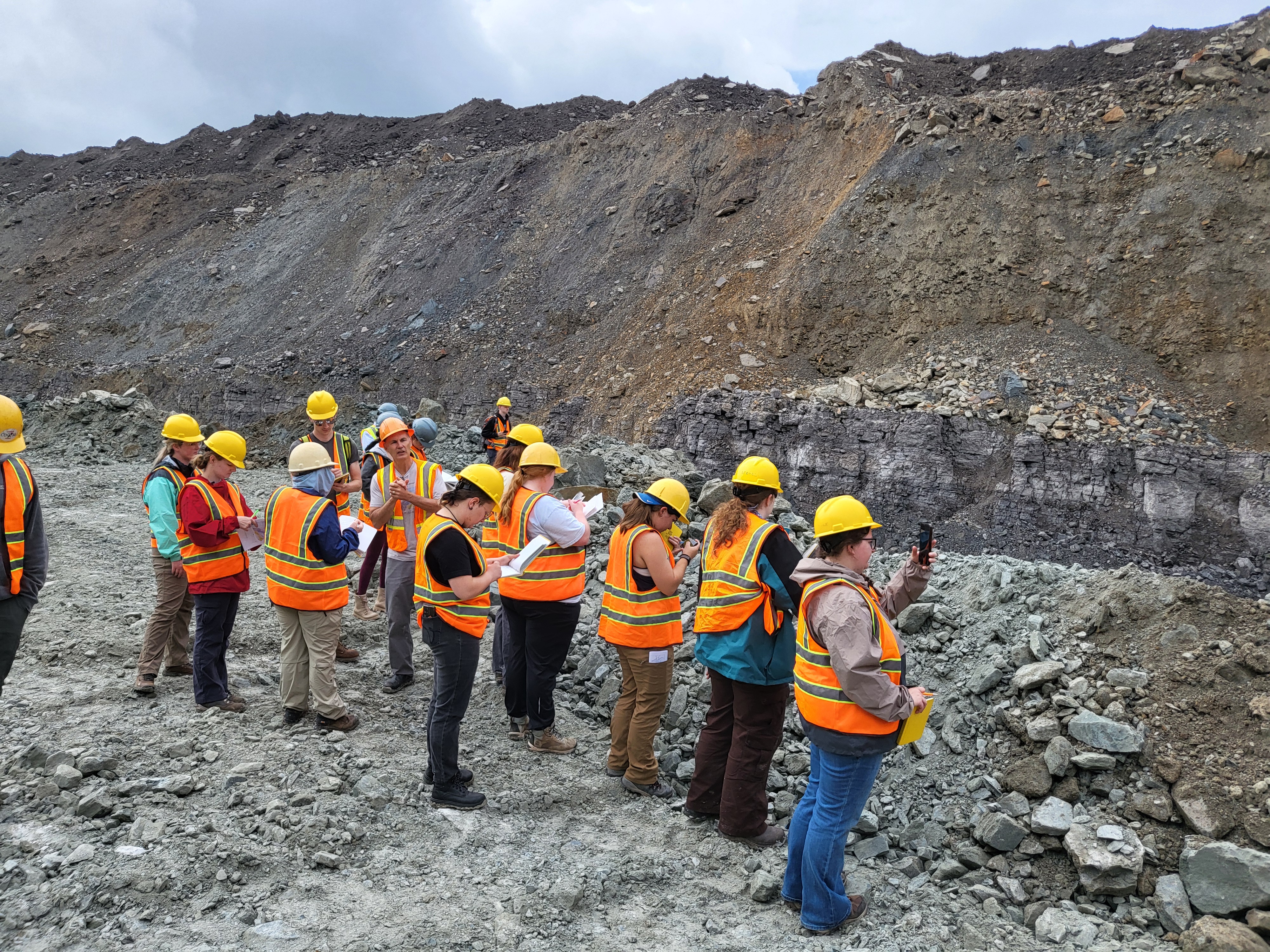
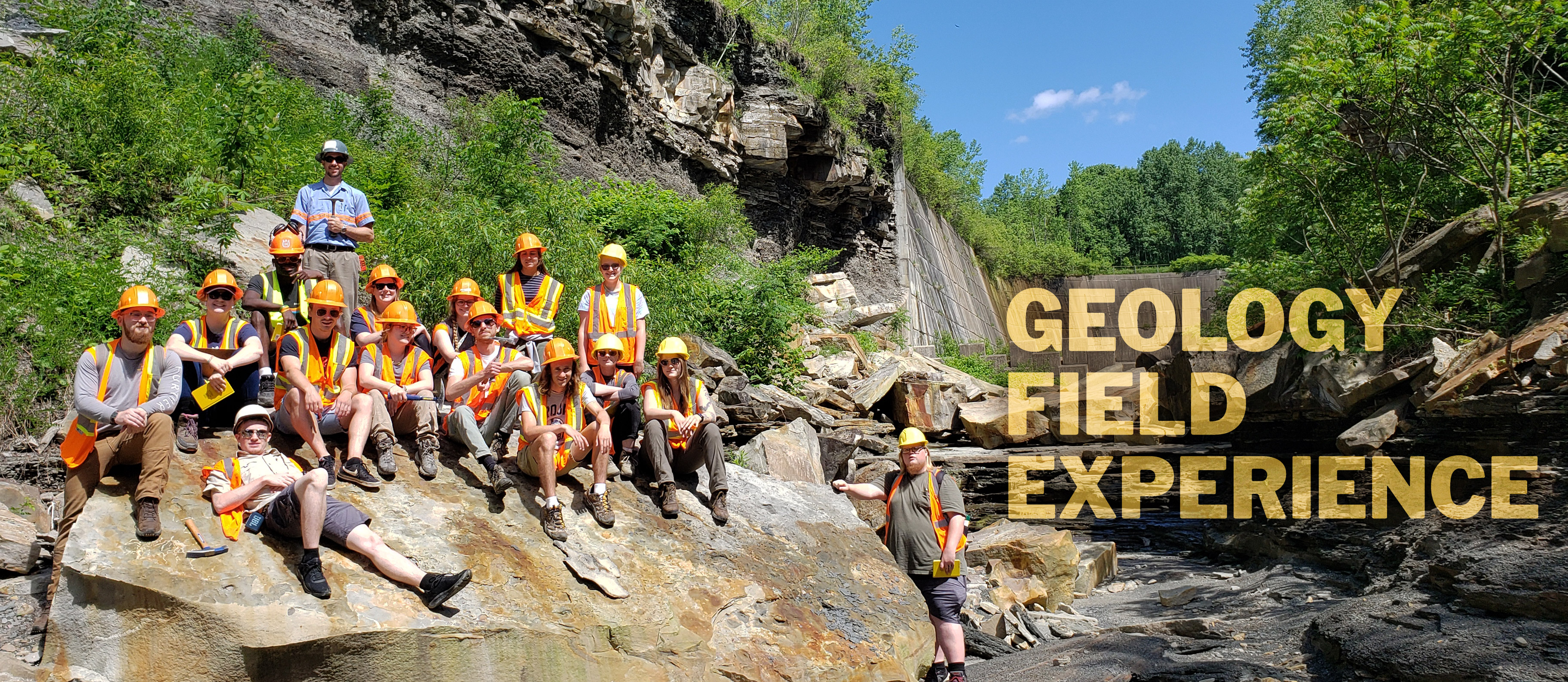
Summer 2025 Highlights
The 2025 course was jointly led by faculty from Shippensburg University and Indiana University of Pennsylvania, with additional instruction from Kutztown University and PennWest University.
Students from six PASSHE universities participated.
Students learned and practiced both traditional and modern field methods where they:
- Mapped surficial and bedrock units
- Measured stratigraphic sections
- Learned drone imagery acquisition
- Used Geophysical imaging technology to map caves
- Completed a GIS landslide analysis
- Investigated karst landforms and completed hydrology investigations
- Measured geochemistry of acid mine drainage remediation sites
Students interacted with and networked with practicing geoscientists at:
- Bureau of Topographic and Geological Survey (Middletown, PA)
- New Enterprise Stone & Lime – Hinkletown Quarry
- Allegheny Mineral – Harrisville Limestone Quarry
Students also participated in community outreach at a mine-drainage remediation site in Lowber, PA, helping high school students collect and analyze water quality data.
Students received hands-on training with professional-grade equipment:
- Brunton compasses for field mapping
- GIS and spatial analysis
- Ground Penetrating Radar (GPR)
- Trimble GPS units
- Topcon Total Stations
- YSI water-quality sondes
- Drone data collection and processing